Blue Corridor – Stream and Floodplain Restoration
The lands within the 100-year floodplain along the Little Conestoga Creek have been dramatically altered over the past century. Our ancestors, who settled and farmed in the valleys of eastern Pennsylvania, were a hardy and resilient lot. They relied on waterpower for much of their energy and the mill-dam system, perfected in Europe, was a technique that was easily transferred to our abundant limestone-fed streams in Lancaster County. In addition to the mill dams, these streams were often relocated to drain floodplains and make them more suitable for farming.
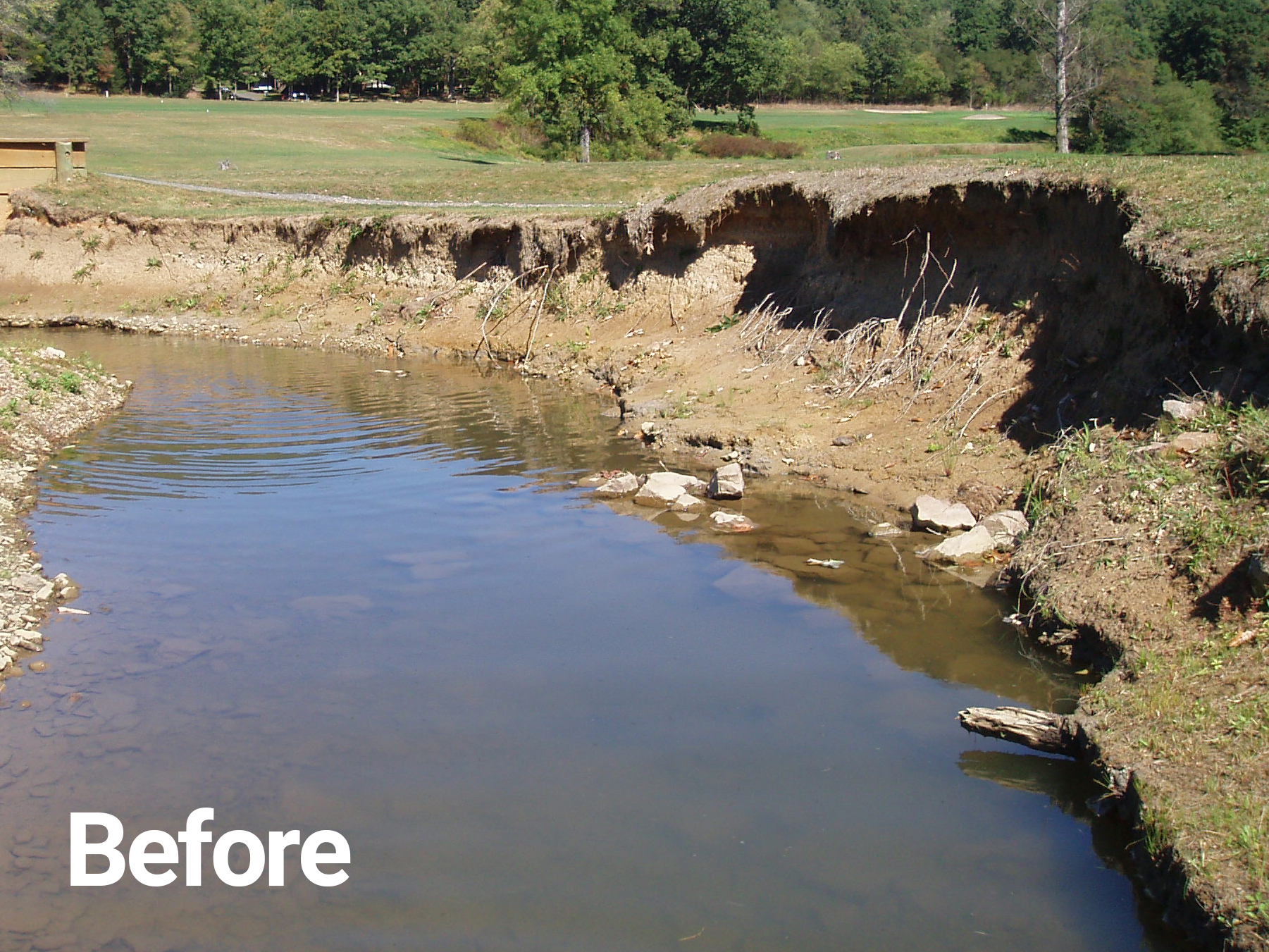
Today we see the results of these practices in the deposition of sediment from eroded upland areas that have choked our floodplains and disconnected our streams from their floodplains. The steep and deeply incised streambanks, that are common throughout the region and evident along the Little Conestoga, are the result of this accumulation of sediment, referred to as “legacy sediment,” which flowed into the valleys and settled-out behind a myriad of mill dams.
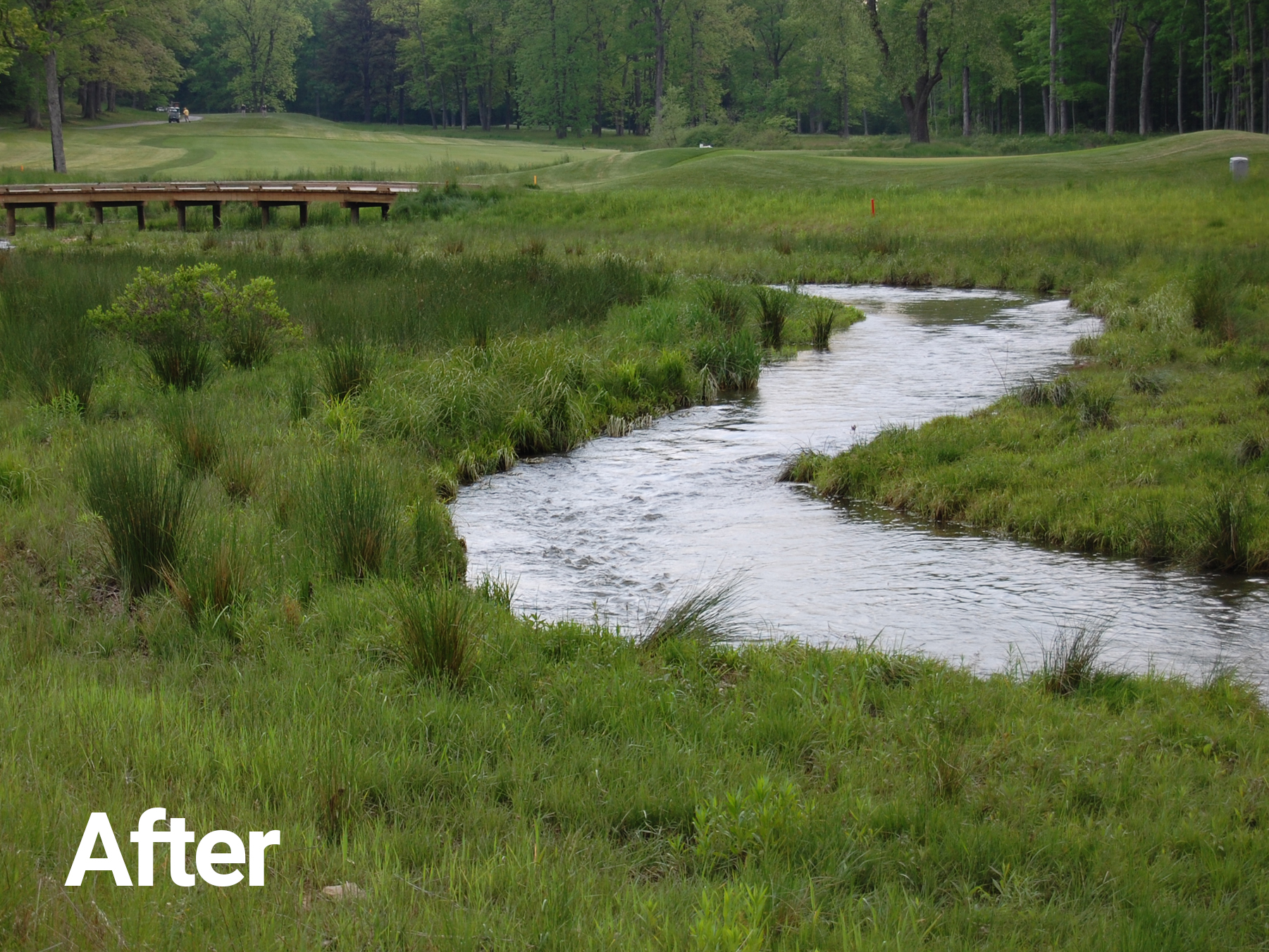
The restoration we are proposing to conduct includes the removal of the legacy sediment within the floodplain and restoring the floodplain back to the functioning ecosystem it was, prior to settlement. Restoring the floodplain, back to its historic condition, provides the following benefits:
Stable streambanks that are connected to the floodplain. Wherever possible the streambank is ideally only 6 inches high, and where constraints limit the amount of restoration, streambank stabilization or “armoring” will be proposed. The reduced erosion from the streambanks dramatically reduces the amount of sediment and pollutants impacting our water quality.
Reduced flooding due to increased flood storage capacity created by the removal of legacy sediment.
More useable upland areas adjacent to the floodplain. As part of the restoration and the associated hydraulic/hydrologic modeling that will be conducted, we can clearly define areas that will be flooded during storm events and provide less flooding in adjacent upland areas. In some areas we can use the excavated legacy sediment to raise the adjacent lands or put them back on the farm fields from which they came.
A bio-diverse native plant community will be established within the floodplain, wherever possible, to filter pollutants, encourage groundwater recharge, provide wildlife habitat and reduce maintenance associated with a functional ecosystem.
Stormwater outfalls will be incorporated into the floodplain restoration to filter runoff pollution before it enters the stream system while also incorporating maintenance of these outfalls into a comprehensive system that improves aesthetics and reduces the maintenance associated with individual, isolated stormwater facilities.
Seasonal interest and aesthetics will be improved with the introduction of a variety of native wildflowers, grasses, trees and shrubs.
Access to and visibility of the stream are improved when the steep embankments are replaced by gradual slopes, making it easier to see the stream from adjacent upland areas and to walk to the water’s edge.
It is our desire that the above information provides you with a better understanding of the approach to and component parts of the stream and floodplain restoration and multi-modal trail improvements that have motivated this project’s development.


