Green Corridor – Trail System
The Project will generate substantial environmental and recreational benefits to the public, including over 3.3 miles of trails that will link residents and visitors to adjoining hiking and biking trails, parks, entertainment venues, shopping, medical services and other essential services.
The Project will create a non-motorized, fully ADA-accessible public trail along the Little Conestoga Creek that will progress northward from the Marietta Avenue Trailhead; cross Marietta Avenue; pass by single-family and multi-family neighborhoods; traverse a pedestrian bridge to lands of Franklin & Marshall College; under the railroad trestle to another bridge to Noel Dorwart Park with connections to its trail and recreational opportunities; to The Crossings and Long’s Park; through the Farmingdale and Route 30 overpasses; to the health services provided by Penn Medicine/Lancaster General Health campus; past the campuses of Mennonite Home and Woodcrest Villa; to the Landis Mill Covered Bridge; with access to Park City, its adjoining commercial uses and to Long’s Park.
This trail system will be used by pedestrians, hikers and, bikers of all ages, providing them with recreational and educational opportunities. The trail will yield these benefits while advancing both the Lancaster County’s Active Transportation Plan and the Greater Lancaster Heritage Pathway Trail.

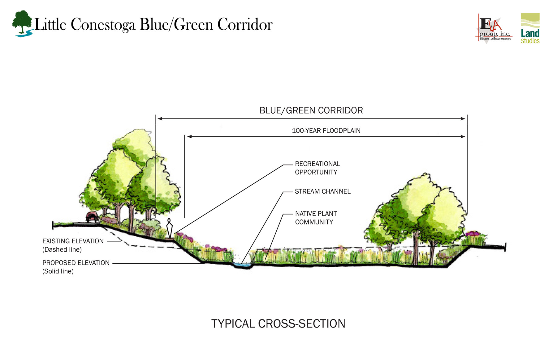
The trail system, developed adjacent to the Blue Corridor, is described as follows:
20-foot-wide to 30-foot-wide trail easements, located on the upland side of the 100-year floodplain, provide a clear transition between the more manicured upland areas or landscapes to the areas being restored.
12-foot-wide, fully ADA-accessible, trail system will provide connectivity between residents/visitors with places of recreation, shopping, employment, and essential services. Except for maintenance vehicle access, the trail would be limited to non-motorized modes of use.
Privacy screening (fences, hedges, berms, and the like) will be provided in coordination with the adjoining landowners.
Educational signs will be installed to teach users about the environmental benefits of the restoration and history of the land uses along the trail.
Directional/wayfinding signs and trail user guides will be provided in strategic locations to guide users and describe restrictions and regulations associated with the use of the trail.
Trailhead parking and informational kiosks will be provided in clearly-defined locations to manage trail access for those using the trail as a destination use.
